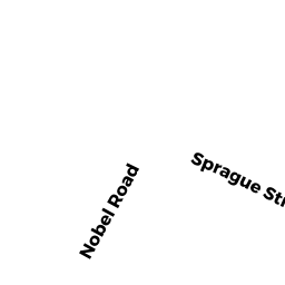
279 SPRAGUE ST
Owner Information
AREVALO NARCISO L JR
279 SPRAGUE ST
DEDHAM, MA 02026


Property Details
279 SPRAGUE ST is classified as a Single Family Residential (Colonial).
The primary structure on this property was built in 1997. There are 4045ft2 of built area within this property. There is 2232ft2 of residential/living space within this property. This property is listed as having 6 rooms.
279 SPRAGUE ST is valued at 580200. The land is valued at 226600 and the structures are valued at 343300. There is an additional valuation of 10300 on this property.
This property is in Zone B. Confirm with local Zoning Board authorities to ensure there are no overlays or other easements on this property.
The most recent deed for 279 SPRAGUE ST is recorded at the local registrar in Book 22218, Page 56. 279 SPRAGUE ST was last sold on 2005-03-28 for 522500.
Assessment data from fiscal year 2020.
Flood Data
According to the FEMA National Flood Hazard Layer, this property does not appear to be in a flood zone. It may also be in an area not yet reviewed. Nonetheless, confirm this information prior to taking any action.
To view the flood hazards around this property, create a FEMA "Firmette" Map of the area around 279 SPRAGUE ST.
Broadband Internet Providers
| Provider | Type | Bandwidth (mbps) | |
|---|---|---|---|
| Viasat Inc | Satellite | 100 | 3 |
| VSAT Systems, LLC. | Satellite | 2 | 1 |
| RCN | Cable | 500 | 20 |
| HughesNet | Satellite | 25 | 3 |
| GCI Communication Corp. | Satellite | 0 | 0 |
| Verizon New England Inc. | Fiber | 940 | 880 |
| Comcast | Cable | 1000 | 35 |
| Crown Castle Fiber | Fiber | 0 | 0 |
Broadband service provider data from December 2020.
Adjacent Properties
- 69 HILLSDALE RD
Single Family Residential owned by CALLAGHAN MICHAEL ETUX - 63 HILLSDALE RD
Single Family Residential owned by WEINGOLD JACK - 271 SPRAGUE ST
Single Family Residential owned by BILLS KRIS ETUX - 281 SPRAGUE ST
Single Family Residential owned by FERRITER STEPHEN ETAL - 287 SPRAGUE ST
Single Family Residential owned by COCO SALVATORE J ETUX